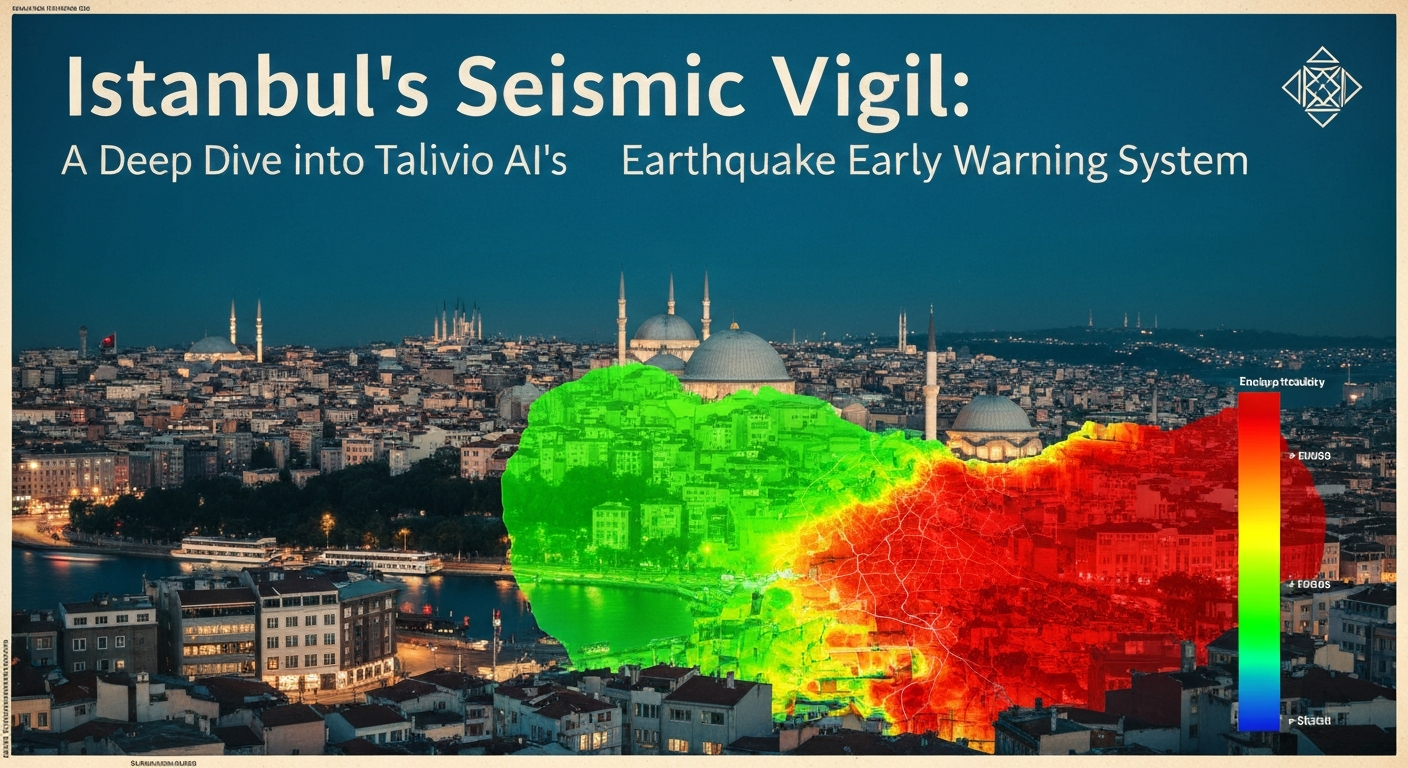
Istanbul's Seismic Vigil: Talivio AI's Advanced Monitoring of the Marmara Region
Istanbul, a city straddling continents and millennia of history, also sits atop one of the world's most active and complex seismic zones. Its strategic location, coupled with a dense urban population, makes understanding and mitigating seismic risk an urgent priority. At Talivio AI, we leverage cutting-edge machine learning to provide continuous, data-driven insights into the dynamic seismic landscape of the Marmara region.
The North Anatolian Fault and Istanbul's Seismic Challenge
The seismic hazard faced by Istanbul is primarily driven by the North Anatolian Fault (NAF), a major right-lateral strike-slip fault system that extends over 1,500 kilometers across northern Turkey. Within the Marmara Sea, the NAF fragments into a complex network of fault segments, forming a pull-apart basin. This intricate geometry complicates seismic hazard assessment, as stress can be transferred between segments in non-trivial ways.
Historical seismicity records indicate that the NAF has a history of producing devastating earthquakes. The 1999 İzmit earthquake (magnitude 7.6, usgs:usp0009z65) and the subsequent Düzce earthquake (magnitude 7.2) ruptured significant portions of the eastern NAF, highlighting the destructive potential of this fault system. The Marmara Sea segment, however, has not experienced a major rupture since the powerful earthquakes of 1766, leading to the widely discussed "seismic gap" hypothesis. This hypothesis suggests that significant stress may have accumulated on this segment, increasing the potential for a future large earthquake [Bohnhoff et al., 2017 — DOI: 10.1002/2016JB013662]. Understanding the current state of stress and activity on these faults is paramount for a megacity like Istanbul, home to over 15 million people.
Talivio AI's Advanced Monitoring Framework
Traditional seismological approaches, while foundational, often face challenges in processing the vast, heterogeneous datasets required for comprehensive regional analysis. Talivio AI addresses this by employing an advanced, AI-powered monitoring framework designed for continuous, high-resolution assessment of seismic activity in the Marmara region. Our system moves beyond static hazard maps, providing dynamic insights into the evolving seismic landscape.
At the core of our methodology is the analysis of 102 distinct seismic features, meticulously engineered from diverse geophysical data streams. These features include, but are not limited to:
- GNSS Strain Rate: Data from Global Navigation Satellite Systems (GNSS) provide precise measurements of crustal deformation, allowing us to quantify the rate at which strain is accumulating across fault zones.
- b-value Anomaly: The b-value, a parameter derived from the Gutenberg-Richter law, describes the relative number of large to small earthquakes. Anomalies in b-value can indicate changes in stress conditions or material heterogeneity within the crust.
- Coulomb Stress Transfer: This metric quantifies how stress changes on one fault segment can influence the likelihood of rupture on adjacent or nearby segments, providing insights into fault interactions [Stein, 1999 — DOI: 10.1038/20485].
- ETAS Parameter Estimation: The Epidemic Type Aftershock Sequence (ETAS) model helps characterize aftershock decay and productivity, offering insights into the underlying stress state and triggering mechanisms in a region.
To process these complex features, Talivio AI utilizes a robust machine learning system. Our platform employs an "algorithm competition" approach, evaluating the performance of several state-of-the-art algorithms, including LightGBM, Random Forest, ExtraTrees, and Calibrated Logistic Regression. This rigorous comparative analysis ensures that the most accurate and reliable models are selected for continuous operation. Furthermore, our system is structured into specific magnitude bands (M4-5, M5-6, M6-7, M7+), allowing for targeted analysis and feature optimization relevant to different earthquake sizes. This multi-band approach enhances the sensitivity and specificity of our monitoring capabilities across the full spectrum of seismic events [Meier et al., 2021 — arxiv:2103.07632].
Deciphering Seismic Signals: Insights from Data
Talivio AI's strength lies in its ability to identify subtle, non-linear patterns within the vast influx of seismic data that might be imperceptible through conventional analysis. Our machine learning models are trained on extensive historical datasets, learning the intricate correlations between the 102 seismic features and subsequent seismic activity. This enables the models to recognize complex signatures indicative of potential stress changes and fault dynamics.
For instance, models show that a localized decrease in the b-value, suggesting an increase in differential stress, when observed concurrently with an elevated GNSS strain rate in a specific fault segment, and a positive Coulomb stress transfer from a nearby active fault, collectively indicate increasing stress accumulation. While these indicators do not constitute a "prediction" in the traditional sense of specifying an exact time, location, and magnitude, they provide critical, data-driven insights into the evolving stress state of the crust. Talivio's real-time model outputs continuously quantify these complex interactions, highlighting areas where seismic activity patterns deviate from long-term averages or expected behavior, thereby offering a more nuanced understanding of seismic risk.
Our systems continuously process incoming data, updating our understanding of fault activity and potential stress changes. The models identify regions exhibiting heightened seismic feature anomalies, which are then flagged for further scientific scrutiny. This dynamic, data-driven approach moves beyond simplistic probabilistic assessments, offering a deeper insight into the physical processes occurring beneath the Marmara Sea.
Enhancing Resilience Through Data-Driven Understanding
The ultimate goal of Talivio AI's advanced monitoring is to enhance seismic resilience in urban centers like Istanbul. By providing continuously updated, scientifically rigorous insights into the seismic landscape, we empower stakeholders with better information for risk mitigation. The data generated by Talivio's models can inform critical decisions in various sectors:
- Urban Planning: Insights into areas of persistent strain accumulation or anomalous seismic behavior can guide decisions on land use, building codes, and infrastructure development, ensuring new constructions are optimally resilient.
- Infrastructure Assessment: Regular updates on regional stress changes allow for proactive assessment and reinforcement of existing critical infrastructure, such as bridges, hospitals, and transportation networks.
- Public Awareness and Preparedness: A deeper, data-backed understanding of regional seismic dynamics can facilitate more effective public education campaigns, fostering a culture of preparedness and resilience among the populace.
Talivio AI provides a dynamic, rather than static, assessment of seismic risk. Our continuous monitoring and analysis mean that our understanding evolves with the Earth itself, offering a living risk profile that is essential for proactive disaster management in seismically active regions.
Conclusion
Istanbul’s profound historical legacy is undeniably linked to its geological setting, placing it at the forefront of seismic risk research. Talivio AI stands committed to advancing our understanding of this complex region through rigorous scientific methodology and state-of-the-art machine learning. By continuously monitoring the North Anatolian Fault and its segments within the Marmara Sea, analyzing 102 seismic features, and utilizing robust AI algorithms, our platform provides unprecedented insights into fault activity and stress changes. We firmly believe that empowering communities with data-driven knowledge is the most effective path towards mitigating urban earthquake risk and fostering a more resilient future for Istanbul and other seismically vulnerable cities worldwide.