The Aegean's Tectonic Dance: A Region Under Extension
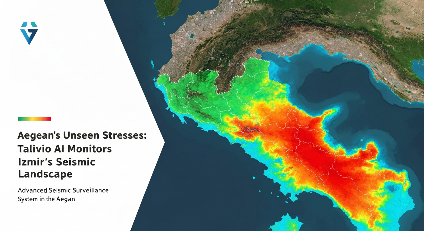
The Aegean Sea and its surrounding landmass, including the vibrant city of Izmir, lie at the nexus of intense geological forces. This region is one of the most seismically active on Earth, a consequence of the complex interplay between the African and Eurasian tectonic plates. While the broader Mediterranean is dominated by the subduction of the African plate beneath Eurasia, the Aegean itself is primarily characterized by an overriding extensional regime. This means the crust is being pulled apart, leading to widespread normal faulting and the formation of prominent graben structures – elongated, down-dropped blocks of the Earth's crust – that define much of the landscape of Western Anatolia.
Specifically, the westward escape of the Anatolian microplate relative to Eurasia, driven by the push from the Arabian plate in the east and the pull of the Hellenic subduction zone to the south, contributes significantly to this extensional stress field. This ongoing deformation creates a dense network of active fault systems, many of which are capable of generating significant earthquakes. Research consistently demonstrates the high strain rates across the Aegean, indicating continuous tectonic activity [Papazachos & Papazachou, 1997 — WorldCat Link]. Major graben systems such as the Gediz (Hermos) Graben and the Büyük Menderes Graben, located within close proximity to Izmir, are prime examples of structures accommodating this regional extension, each hosting numerous active faults with documented seismic histories.
Echoes of the Past: Seismic History and Recurrence
The history of Izmir and the Aegean is inextricably linked with seismic activity. Archaeological records and historical documents recount numerous destructive earthquakes that have shaped the region's urban development and cultural memory. This long history of seismicity underscores the persistent nature of earthquake hazards in this dynamic environment. The region experiences a high rate of moderate to large earthquakes, a direct consequence of the continuous accumulation and release of tectonic stress along its intricate fault network.
A recent and stark reminder of this seismic reality was the M7.0 Samos earthquake on October 30, 2020. This event, centered in the Aegean Sea northeast of Samos island, generated significant shaking that was widely felt across the region, including in Izmir, where it caused building collapses and fatalities [usgs:us7000c7y0 — USGS Event Page]. Such events highlight the interconnectedness of the Aegean's fault systems and the potential for large-magnitude earthquakes to impact densely populated areas. Understanding the recurrence intervals and spatial distribution of these events is crucial for effective risk assessment, a task greatly aided by continuous, data-driven monitoring platforms like Talivio.
Talivio's AI: Unraveling the Subtle Signals of Stress
Given the complex and highly active tectonic setting of the Izmir and wider Aegean region, continuous and sophisticated monitoring is paramount. Talivio's AI-powered platform is specifically designed to address this challenge by constantly observing the myriad subtle signals emanating from the Earth's crust. Our methodology moves beyond traditional seismic catalog analysis, leveraging advanced machine learning to identify patterns that might precede significant seismic events.
Multidimensional Feature Engineering
Talivio's AI models are trained on an extensive dataset comprising 102 distinct seismic and geodetic features. These features are meticulously engineered to capture a comprehensive picture of crustal deformation and stress accumulation. Key features include:
- GNSS Strain Rate: Data from Global Navigation Satellite Systems (GNSS) provides precise measurements of ground deformation, indicating how quickly the crust is stretching, compressing, or shearing. Anomalies in strain rate can signify changes in stress accumulation on underlying faults.
- b-value Anomaly: The b-value, derived from the Gutenberg-Richter law, describes the relationship between the magnitude and frequency of earthquakes. A decrease in the b-value often correlates with an increase in differential stress within a rock volume, potentially indicating a heightened likelihood of a larger earthquake. Talivio monitors deviations from the regional background b-value.
- Coulomb Stress Transfer: Earthquakes do not occur in isolation; the slip on one fault can increase or decrease stress on neighboring faults, influencing their seismic potential. Coulomb stress transfer models quantify these interactions, providing insights into how past events might influence future seismicity.
- ETAS Parameter Estimation: The Epidemic Type Aftershock Sequence (ETAS) model helps to distinguish between background seismicity and aftershock sequences. By continuously estimating ETAS parameters, Talivio can identify anomalies in the rate and clustering of earthquakes that deviate from expected patterns, potentially indicating changes in the underlying tectonic stress field.
Advanced Machine Learning Algorithms
The 102 seismic features are fed into a suite of sophisticated machine learning algorithms. Talivio employs an ensemble approach, utilizing a competition between several powerful models to ensure robust and reliable insights. Our core algorithms include:
- LightGBM: A gradient boosting framework that uses tree-based learning algorithms, known for its speed and efficiency in handling large datasets.
- Random Forest: An ensemble learning method that constructs a multitude of decision trees during training and outputs the mode of the classes (classification) or mean prediction (regression) of the individual trees.
- ExtraTrees (Extremely Randomized Trees): Similar to Random Forest but introduces more randomness in the tree construction, which can improve generalization.
- Calibrated Logistic Regression: A linear model used for classification, with calibration techniques applied to ensure that the predicted probabilities are well-aligned with the true probabilities of an event occurring.
This algorithmic competition allows Talivio to identify complex, non-linear relationships within the seismic data that might be imperceptible to human analysis or simpler statistical methods. The models are continuously retrained and validated against new data, ensuring their adaptability to evolving tectonic conditions [arxiv:2303.02324 — arXiv Link].
Magnitude-Band Specific Risk Assessment
Recognizing that earthquake impacts vary significantly with magnitude, Talivio's system assesses risk across specific magnitude bands. Our models are trained to evaluate the likelihood of events within:
- M4-5 (Moderate)
- M5-6 (Strong)
- M6-7 (Major)
- M7+ (Great)
This band-specific approach allows for a more nuanced understanding of potential hazards, enabling communities and authorities to tailor preparedness strategies to the specific scale of anticipated seismic events. By continuously analyzing these features and patterns, Talivio's AI identifies subtle changes in the seismic behavior of the Izmir and Aegean region, providing critical, data-driven insights into evolving earthquake risk.
Beyond Data: Informing Resilience in the Aegean
The insights generated by Talivio's AI platform are not intended for deterministic prediction but rather for enhancing risk analysis and informing preparedness strategies. By providing a continuously updated, probabilistic assessment of seismic activity, Talivio empowers stakeholders to make more informed decisions.
For urban planners in Izmir, this means the ability to review and update building codes based on the most current understanding of regional stress accumulation. For emergency management agencies, it translates into better-targeted public awareness campaigns, more effective drill scenarios, and optimized resource allocation. For the general public, access to transparent, data-driven risk assessments fosters a culture of preparedness and resilience, essential for living in a seismically active region.
Talivio's commitment is to translate complex geological data into actionable intelligence, fostering a proactive approach to earthquake safety in the Aegean. Our continuous monitoring and advanced analytical capabilities serve as a vital tool in the ongoing effort to mitigate the impacts of seismic events and build more resilient communities.
Conclusion
The Izmir and wider Aegean region, with its stunning landscapes and rich history, remains a testament to the powerful forces constantly at play beneath the Earth's surface. Its dynamic extensional tectonics and intricate fault systems ensure a persistent seismic hazard. Talivio's AI platform stands at the forefront of this challenge, offering an unprecedented level of continuous, data-driven monitoring.
By meticulously analyzing 102 seismic features with advanced machine learning algorithms across specific magnitude bands, Talivio provides critical insights into the evolving seismic landscape. Our aim is to move beyond mere observation, transforming raw seismic data into actionable intelligence that strengthens risk analysis and enhances preparedness, ultimately contributing to a safer and more resilient future for the communities of the Aegean.